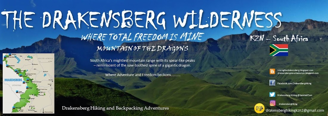

“A
mass of Spears. Named thus by the Zulu warriors before the white man came.
Today called the Drakensberg, Mountains of the Dragon, a name given by the
Voortrekkers. Evocative names, both equally applicable to South Africa’s
mightiest mountain range with its spear-like peaks – reminiscent of the
saw-toothed spine of a gigantic dragon.”
Panorama April 1966

“Listen to the streams as they gurgle from their cradles and you will hear the story of the mountains. You will hear fascinating tales if only you listen! Lie next to a stream and listen to the song of the mountains. The smiling faces of the flowers, dancing in the wind. Venture into the remote valleys or stand on a peak at sunrise or sunset, after snow has fallen, and you will hear a song that you will never forget - the Song of the High Mountain". (DA Dodds)
Hiking adventures, hiking gear reviews, day walks, accommodation, books, articles and photos, all related to these magnificent mountains will feature here.
Should you want to accompany me on a hike, or need some information or advice, please make contact with me. I hope you enjoy the articles.
Please visit the archive for some more interesting stories, photos and reviews.
Please note that all photos on this blog are copyright protected. If you would like to obtain
“WHEN WE REACH THE WILDERNESS AND THE MOUNTAIN SUMMITS,
WE LEAVE BEHIND US ALL THE THINGS THAT WEIGH HEAVILY ON OUR
BODY AND OUR SPIRIT”

Northern
Drakensberg
ROYAL
NATAL NATIONAL PARK

LOCATION
The park lies 72 km from
Harrismith, via the Sterkfontein Dam and Over Oliviershoek Pass. It is 48km
west of the small town of Bergville along a tarred road. The road is well sign
posted.
The nearest town which has
a full range of services is Bergville.
OVERVIEW
The Royal Natal National
Park is the only national park in KwaZulu-Natal and is characterized by the amphitheater,
a magnificent rock wall reaching heights of 500m, as well as the Thukela Valley
and Gorge. Mont-aux-sources (3 282m), one of the peaks dominating the amphitheater
is the source of 5 major rivers including the Tugela River, which plunges down
as the Thukela Falls coming down in five steps as one of the highest waterfalls
in the world. Other peaks dominating the scene are the Eastern Buttress (3
048m) and the Sentinel (3 165m) The Royal Natal National Park is one of the
best-known and most popular destinations in the Ukhahlamba Drakensberg Park.
Adjoining Royal Natal is
the Rugged Glen Reserve, which together are managed as one unit by Ezemvelo KZN
Wildlife

CLIMATE
The weather is subject to
change at short notice and hikers should be well equipped and fill in their
details in the Mountain Rescue Register.
ACCOMMODATION
Mahai
and Rugged Glen Campsites
An entrance fee is
payable on arrival at the park’s entrance gate for day visitors. Visitors to
these two campsites must arrive before sunset and report to the visitor’s
centre. Reservations for campsites may be made by phoning the above number.

Mahai Campground
Mahai has
camp facilities for 400 campers. Only camping and caravanning is available. The
campsite is set among shady trees and there is a large central area where
children can play in safety. There are 5 communal ablutions and washing up as
well as laundry facilities are available. Electrical points are available on
request in these camps.
Rugged
Glen Campsite
Campsites are available for
45 people. There are communal facilities, including hot and cold water and
electrical plug points.
The curio shop at the
visitors centre sells limited food supplies and souvenirs.
Thendele
Hutted Camp
Considered by many to be
South Africa’s most popular mountain retreat, this highly sought after camp is
set at the back of Dooley, high on the side of the slope and offers spectacular
views of the Amphitheatre and Policeman’s helmet and Vemvaan Valley in the
foreground. Views of the mountains can be seen from every bungalow. In winter
the amphitheater is often covered in snow in winter or with up to eighteen
waterfalls cascading down the vertical cliffs after a storm. The camp, which is
split into upper and lower sections, consists of 26 comfortable self-contained
chalets that accommodate either two or four people each. There are barbeque
facilities next to each hut and a cook is available to prepare food for
guests. Guests must supply food and beverages.

Cottages
There are also two
delightful 6 bed cottages
Thendele
Lodge
The lodge has 3 en-suite
bedrooms and other facilities in keeping with 5 star accommodations in its own
special space well away from the main camp. Each room has two single beds, a
kitchen large living area and fireplace. There are barbeque facilities next to
the lodge and a cook is available to prepare food for guests. Guests must
supply food and beverages.
The cottages and the lodge
each have their own cook who will prepare delicious meals from the provisions
supplied by the visitors.
The camp management can be
contact directly to find out if immediate cancellations exist on Thendele’s
accommodation.
ACTIVITIES
Hiking
The most popular activity
is hiking and the Royal Natal Park has 83km of self-guided walks. These walks
afford views of incomparable scenery. Each of the 30 hikes is well marked and
maintained in the reserve. Maps, hike descriptions and books are available at
the visitor centre. Visitors are urged to leave information of their expected
hiking routes with friends or at the visitors centre, in case the need for help
may arise.
Popular hikes are listed
below:
Short walks
Starting from Mahai
campsite or the picnic ground.
Cascades and McKinlay’s Pool (easy)
Take the campsite road from
the casual car park. Walk along past the campsite. Fifteen minutes’ walk brings
you to the Queen’s causeway and the Cascades.
Time: Circular trip 1 hour Distance: 5km
To make a round trip,
though the going is steep, a footpath leads to Dooley from the boulders near
McKinlay’s pool, joining the tiger Falls/ Gudu Bush path. Return via Tiger
Falls/ Gudu Bush (Intermediate)
Time: 1 hour 45 mins Distance: 8km.
Fairy Glen. (Easy to average)
Start down the main road
and cross the bridge at the visitor’s center. Then take the path to the left
leading through the bush to the Broome Hill stream. Cross and re-cross this,
then follow up through the bush to the waterfall. This is a beautiful glen that
makes a delightful picnic spot.
Time: 20 min Distance: 1,6km.
Otto’s Walk. (Easy)
The walk starts at the far
side of the visitors centre car park. This is a self-guided educational trail
that winds along the Mahai and Thuleka Rivers. Many trees are marked for
identification.
Time: 45 min. Distance: 3km.
Sunday falls (easy)
Cross the Mahai River below
the casual car park. Follow the path up and across the intersection. It is
signposted. Continue onto the Surprise Ridge path. At the turning leading down
to the falls is a signpost. Cross above the falls and a track will be found
leading down to the foot of the falls.
Time: 1 hour Distance: 3km

Forest Walk. (Easy)
This route is well
signposted. In the Rugged Glen area a circular walk may be taken along a path
from the visitor’s car park up the valley, turning right along the path leading
through several attractive bush patches to the Karos Mont-Aux-Sources Hotel.
From here the route along the boundary fence, and via the road back to the
visitor’s car park, is obvious.
Time: 50 minutes Distance: 4km.
Camel’s
Hump
This route is signposted.
From the visitor’s car park at Rigged glen, follow the path up and then across
the stream, turning left at the first junction, and so on up to the Camel’s
Hump, from which magnificent views are to be had.
Time: 1hour 10min Distance: 5km.
Longer walks
Tiger
Falls. (Intermediate to difficult)
These falls are situated in
an indigenous forest.
From Thendele Camp, Tiger
Falls is an easy 30 min walk along the path below Dooley.
Time: 45min Distance: 3km
From the campsite these
falls can be reached by continuing on from the cascades walk. The falls are
reached at the first large stream and forest patch below Dooley. Return by
crossing the Mahai River, turn right when the bush is reached and continue
through the forest, back to the campground.
Time for circular walk: 1hour 45min Distance: 7km.
Rugged
Glen. (Easy)
To reach this area from the
Mahai campground, take the Bergville road as far as the park entrance. Turn
left along the Mont-Aux-Sources Hotel road, and left again up the Rugged Glen
track to the Visitors car park.
Time: 2 hours Distance: 7km
Hikers can return to the
campsite over the Camel’s Hump (see short walks) and Surprise Ridge, where you
meet the path to the Cavern.
As an alternative route,
turn right and proceed to the Cannibal Caves (1,2km) then return to the
campsite via the Surprise Ridge Path.
Time round trip: 7 hours 30min Distance: 23km.
Gudu
Falls. (Intermediate to difficult)
From Thendele take the path
past Tiger falls to the Gudu Bush. Soon after the stream is crossed a path to
the left will lead to the magnificent falls.
From the campsite continue
towards the Mudslide and into the Gudu Bush. Turn right at the signpost and
follow the steep path above and out of sight of the stream for about 1 600m,
when the Gudu Falls will be reached.
Round trip: 3hours 30min Distance: 9km
Dooley
Waters and the Mahai Valley. (Intermediate to difficult)
Proceed to the upper end of
the Gudu Bush. Continue up the valley on the main bridle path overlooking the
Mahai stream for about 2,5 km.
Cross the Mahai stream, a
very attractive picnic spot, and continue up the north-facing slope until a
path junction is reached.
Turn left up the Dooley
Waters path, or alternatively right to continue further up the Mahai valley to
Basutu Gate.
NOTE: The Nek and the path
from the Nek to the Basutu Gate path are closed. The Dooley Waters path is
therefore a cul-de-sac.
Time: 2 hours
30min
Distance 7km

The Sentinel
From the car park at the
visitors centre, walk via Thendele Camp to Mahai Falls. Finally ascend the Amphitheatre by means of
two chain ladders of 100 rungs.
Time: 18hours Distance: 45km
The Gorge
From the car park below
Thendele follow the direct and well signposted route. There are community
members who will watch your cars.
Time:
5.5
hours
Distance: 23km
Rock climbing
Is permitted only to
members of the Mountain Club of South Africa (MCSA) and arrangements need to be
made in advance.
Horse Riding
Rides odd various lengths
from full day to two hours can be organized and are available at Rugged Glen.
For safety, children younger than 12 can only go on pony rides and a guardian
must accompany children age between 12 and 14.
Bookings must be made in
advance. Telephone number: (036) 438
6422.
Stables are open from 08:00-10:00
and 13:00-14:00.
Trout Fishing
Available in rivers and two
dams. Only trout fishing equipment is permitted. Permits are available at the
Visitors Centre.
Picnics
There is a lovely picnic
site at Mahai Dam, but hikers are encouraged to take picnics with them on
hikes. Fires may only be made in designated places and refuse should be put in
bins.

FACILITIES
The shop is well stocked
with curios and supplies.
The nearest town which has
a full range of services is Bergville which is 50 kms away
Bookings
KZN Wildlife Reservations
P.O. Box 13069
Cascades
3202
Tel: (033) 845 1000
Fax: (033) 845 1001
Email: bookings@kznwildlife.com
Website: www.kznwildlife.com
Campsites are booked
directly through the camp:
Private Bag X1669
Bergville
3350
Tel: 036 438 6303
Fax: 036 438 6231
Office Hours: 08h00-16h30
daily
The End.
Safe Hiking.

References and Acknowledgements
Photos – W Pelser
Compiled by - W Pelser – Information supplied by
Ezemvelo KZN Wildlife


